
county list
![]()
|
Turn smartphone to horizontal
view. SELECTED SITES IN COUNTY ANTRIM Place-names in italics refer to listed entries. Convert Irish Grid references to Latitude/Longitude |
|
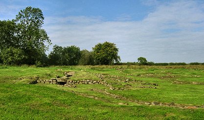
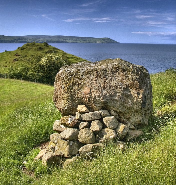
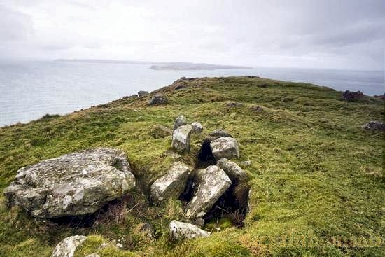
Antynanum:
Court-tomb and Standing-stones
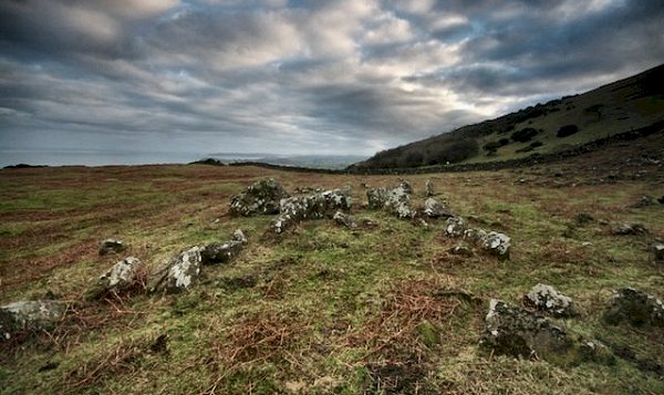
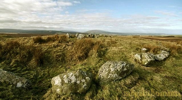
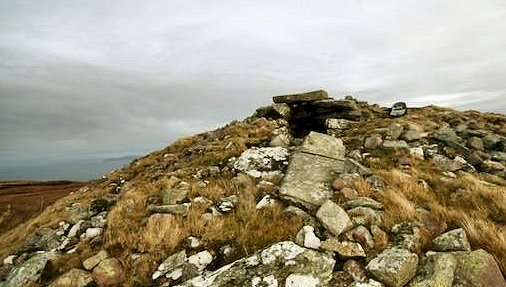
D 256 110 Sheet 9 The court-tomb is perhaps the longest in all Ireland, being a massive tapering cairn of boulders up to 2 metres high and 70 metres long. Two chambers of a gallery can be discerned behind the forecourt (over 12 metres wide) at the E end. This is formed by fourteen upright slabs and one fallen slab - none of them tall. One has a cup-mark reminiscent of the N court of the tomb at Ballywholan (Tyrone). Near the W end inserted into the N side is a wrecked portal-tomb with a half-door stone, which seems to have had a massive, gabled-capstone sitting on another. In front of this are the remains of a little cairn. Parallel with and several metres beyond the N kerb is a long line of stones. The surrounding area has several such, while at the top of the hill is a very large, roughly-triangular enclosure with bank and external ditch, with evidence of several structures within.
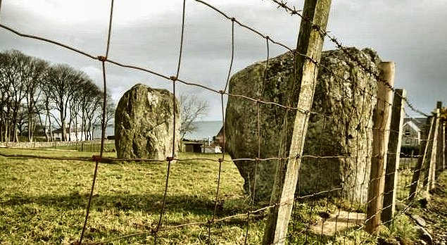
~ About 500 metres WNW (D 252 112) is a good male-and-female pair of basalt stones visible from the by-road to the S. One of them is 'riddled with cracks'. A stone kist was discovered in the same field. - 700 metres SE of the tomb in the same townland (D 260 104, in a rushy field and visible from a track) is another charming pair of standing-stones, known as 'The Maidens'.
~ 1.5 km SW in Tamybuck (D 246 099), S of a by-road, is a massive wedge-tomb somewhat eroded and tumbled on the S side by quarrying, but still retaining a large part of its cairn. The gallery-orthostats and some outer walling are visible, but the roofstones have either been removed or slid aside.
~ Just over 2 km WNW is Ticloy "Stone House". Altagore:
Stone fort Picturesquely
visible 300 metres W of the coast road from Cushendun to Ballycastle
via Torr Head, about 2 km N of Cushendun, the wall of the cashel
(derived from the same Latin word as castle) survives
to a height of 3 metres, and the internal diameter is 15 metres.
There are traces of steps leading up to remains of a terrace.
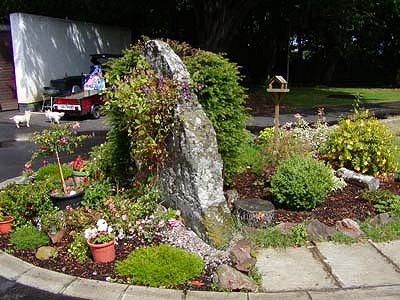
~ 1.5 km SW at the entrance to a caravan-site in Cushendun is a large semi-elliptical slab which is one of a former pair of standing-stones - now surrounded by ornamental plants.
~ 8 km SSW in Lubitavish (D 213 285) is the once well-signposted "Ossian's Grave", a small court-tomb with a three-chambered gallery about 3.5 metres long, near which is a little cairn of stones marking the grave of John Hewitt, one of the dullest of the generations of dull poets writing in English since Yeats and Stevens.
~ 650 metres SW in Cloughs is a small passage-tomb ("Cloghancor") whose capstone has been tipped into what was the original entrance, revealing the five supporting stones. From it are splendid views to Cushendall Bay to the E, while to the SW Tievebulliagh is dramatically prominent. ~ 10
km SSW at Tievebulliagh (D 193 268) is a neolithic
axe-factory. Three small outcrops of porcellanite can be seen
on the higher SE slope of this conspicuous peak. Rejects,
flakes and part-finished axe-heads may still be found round
about and on the hilltop - but no finished ones. It was here
that the axe-heads were roughed out before being finished
at the seashore at Whitepark Bay, and exported all over the
British Isles. The cairn on top of Tievebulliagh is probably
of Bronze Age date. ~ 5.2 km WNW are Ballyvennaght
portal-tombs. Ballygilbert:
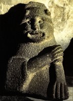
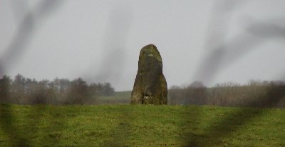
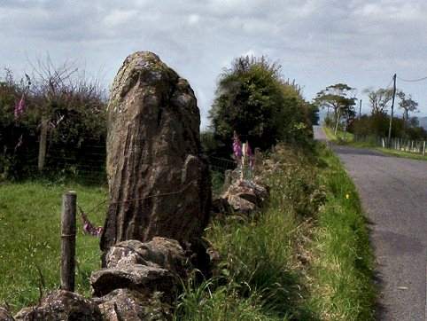
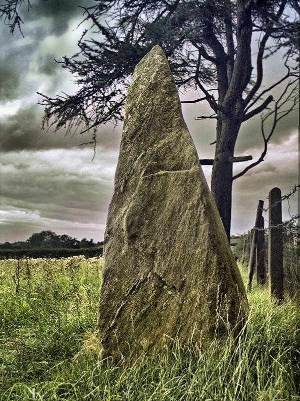
Standing-stone click
the thumbnail for a hi-res picture Near the top of Ballygilbert Hill (300 metres), and offering fine views over the North Channel to Scotland, close to the "Ulster Way" footpath, this small (1.5 metres high) but well-sited Cloughogan is remarkable for its unmistakeably phallic form. It is, however, nearly an hour's walk from the car-park/viewpoint to the S. ~ 750 metres NE, in Lisnahay South (D 341 108, not marked on the map) is a well preserved court tomb, whose north-facing court leads into a two-chambered gallery, with two subsidiary chambers on either side of the S end.
~ 1.3 km SE, in Ballygawn (D 344 096, marked Chambered Grave ) is "Cloghogan", a small passage-tomb - similar to the one at Ballylumford some 11 km SE - very close to a ruined house, and once used as a pig-sty. There are solution pits on the front of the (slipped and cracked) capstone, at least one of which seems to have been enhanced by human hand. The orthostats seem to have been chosen for the interesting grooves on the internal faces.
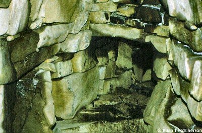
~ 1.8 km WNW is Gowkstown (or Goakstown) wedge-tomb. [~ 3.3 km SE in Ballyhackett (D 348 068) is a good example of a Viking-period souterrain set at the base of a steep rock face. It is now entered from the W side of a field wall, but the original entrance is more likely to have been on the E side of the wall. The linear arrangement of passages in the form of an F, and the frequent occurrence of creeps (very low passages), indicate that the main function of the souterrain was refuge and defence rather than storage. The total length is about 80 metres, with a total of six simple creeps as well as a 'drop-hole' creep. This type of monument is neither prehistoric nor megalithic, but is nonetheless included here. Another souterrain is listed in county Down under Drumena.]
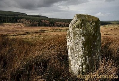
~ 6 km due S (D 337 043), clearly visible to the E of a by-road on White Brae in Killyglen, is a fine knobbly sandstone standing-stone 2 metres high, from which there are fine views S to the beautiful contours of Agnew's Hill, and to the port of Larne.
~ 1 km NW of the car-park and viewpoint, on a little knoll at D 323 080 in Dunteige is a roofless wedge-tomb whose rear end has been badly damaged, but which retains its double walling. To the right of the split portico at the front is a single façade stone, and behind the portico is a septal slab that blocks only one side of the entrance to the gallery, which is aligned roughly WSW towards the volcanic plug of Slemish.
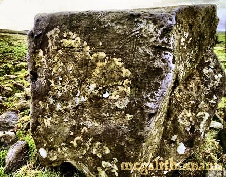
100 metres N of Dunteige wedge-tomb is a boulder carved with a Clonmacnois-style Latin cross with expanded ends. The boulder was used as a Mass Rock for clandestine Catholic worship during Penal Times (1798-1830).
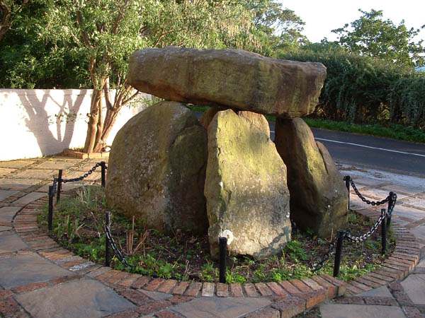
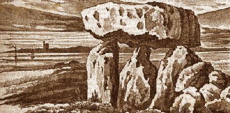
Ballylumford:
Passage-tomb ?
An engraving of the tomb in 1832, looking across the narrows to Larne Castle. ~ 11 km WSW, between the Upper and Lower Ballyboley roads in Ballyboley (J 328 973), in an isolated thicket of thorn and holly 200 metres NW of the high-tension pylon to the SW of the famhouse at the top of the lane, are the remains of a court-tomb which retains two of its roof-stones. The front one is a fine gabled stone sitting on the orthostats immediately behind the entrance-jambs. A few court-stones survive on the E side, the outermost set into the edge of a platform of cairn material. There is a kist at the S end. The tomb was, interestingly, known as The (L)ebby within living memory -from Irish 'leaba', meaning 'bed', referring to the legend of Diarmuid and Gráinne. It has been wrongly transcribed as 'The Abbey' by illiterate antiquarians, just as the tomb has been wrongly identified as 'Carndoo'. 200 metres N is a standing-stone known as "The King's Stone", 2.5 metres high, incorporated into a field-dyke, while around 180 metres SW is - or was - part of the court of Carndoo (= Carn Dúbh or 'The Black Cairn'), another court-tomb. It was here that a small inscribed stone with hatched engravings (cf Ballyrenan, Tyrone) was found in the mid-19th century. ~ Just
over 10 km SW, almost on the S edge of sheet 9 (J 350 952),
in Ballygowan, is a handsome anthropomorphic monolith
of sandstone, 1.4 metres high, incorporated into a field-wall
on the S side of a track.
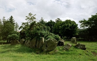
Ballymacaldrack:
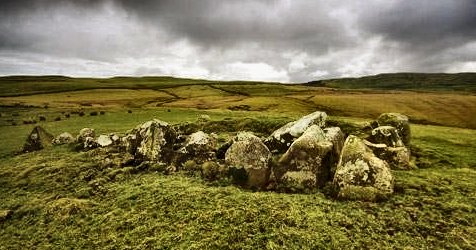
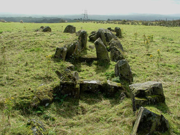
Court-tomb Situated 1.2 km SSE of Dunloy, Doey's Cairn has a fine and almost intact forecourt post-dating the rest of the sepulchre by some 500 years and thus, perhaps, providing some evidence for the gradual development of court-tombs in Ireland. Between the large orthostats of the court, small filling-stones may be seen. The egg-shaped cairn is bounded by a kerb of low boulders, and has a single chamber facing, unusually, SW. Beyond the chamber is a passage which was used as a cremation chamber: the burnt bones of at least 5 adults were placed in one of 3 pits dug in the otherwise paved floor. ~ 4.4 km WSW is 'The Broad Stone' at Craigs. ~ Just over 5 km SE, crowning a little knoll just E of the road in Dromore townland (D 048 137) is a shapely, fissured standing-stone about 1.2 metres high. A cross has been discerned, carved into the centre of the SE face.
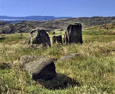
Ballyvennaght:
Portal-tombs and Standing-stone 6.5 km NW of Cushendun,
and 400 metres SSW of the standing-stone marked on the map known
as 'Cloch na h-Uaighe' and 'Cloghacarna', a pair
of portal-tombs (not marked on the map) lie about 20 metres
apart, mostly below the level of the surrounding moorland which
has been excavated to reveal them. The westernmost tomb (Cloughananca)
is a fine example, with a large capstone about 3 metres across.
and a sill-stone. One side-stone is missing. The portal stones
are 1.5 metres high. Between this tomb and the second, which
collapsed under the weight of its capstone - perhaps not long
after, or even during, its construction - traces of the cairn
which contained them both can still be seen. From here both
the standing-stone in the same townland and the passage-tomb
on Carnanmore (2 km NE) are visible just behind Cushleake
Mountain North. ~ About 900 metres ESE at D 209 366 (GPS: D 20928 33628) is another, smaller, portal-tomb almost buried in bog and located next to a fast flowing stream on a gentle west-facing slope. The displaced capstone is 2.1 metres across and 1.5 metres thick, and just 60 cms of the portal-stones are visible.
~
Some 200 metres E of the latter portal tomb, at D 207
365 (GPS D 20747 36486) is yet another portal-tomb.
Only 50-60 cm of the orthostats stand proud of the peat
and this is only the case because the peat around the
site has been cut a little. If the peat was undisturbed
I am not sure if anything sould be visible at all, part
from the top of the two-metre-long capstone which is slightly
displaced, but still covers the chamber (nearly full of
cairn rubble). The entrance faces roughly south. One very
interesting thing to note about this site is that some
cairn material survives just under the present ground
surface in front of the entrance. This would indicate
that the entrance was either blocked off at some point
or that the monument originally stood within a cairn that
reached at least up to its capstone. It is very rare to
find a portal tomb in this state, making this a very significant
monument.
~ Included in the itinerary of Ballypatrick Forest Drive (for which there is a charge per car), and 2 km WSW of Loughareema, in Glenmakeerin townland, are the remains of a double-court tomb (D 185 350, signposted), the more northerly (three-chambered) gallery of which still retains two of its roof-stones (one of them large and displaced) and only two of its court-stones. Only one court-stone of the other (unsegmented) gallery survives. ~ 4 km NNE of
the portal tomb at Cloughananca is possibly the largest
passage tomb in the area at West Torr (D 213 406).
The kerb is massive and 15 metres across, with some of the
stones being over 2 metres in length and 1 metre high. At
the centre of the monument a handful of large stones define
parts of the central chamber. Some of these are over 1.5
metre tall. The backstone of the chamber is heavily encrusted
with quartz pebbles, and there is a solitary red stone just
outside the kerb to the southeast. The site seems to stand
inside the compound of what may have once been an army listening
post. A weird barrack-type building stands just down the
slope and the hilltop bristles with aerials.
~ 5.2 km ESE is Altagore cashel or stone fort. ~ 6 km WSW in Duncarbit
(D 147 347) is a fine pair of standing-stones of distinctive
shape, beautifully situated with views to the North Channel
and Rathlin Island, a semi-amphitheatre of hills to the S and
W, and the impressive maternal basaltic dome of Knocklayd
to the N, which is, significantly, girdled by standing-stones,
and dominates a wide area. The
cairn on top - 'Carn-na-truagh' or Cairn of Woe, 4
metres high and 20 metres in diameter - commands amazing views
in all directions, including the North Antrim coast and the
passage-tomb at Carnanmore, the Scottish Isle of Arran
and the Mull of Kintyre. It has an abundance of white quartzite
stones, and part of its boulder-kerb is visible on the W side.
Ballyvoy:
Passage-tomb and Court-tomb Overlooking the ruined court tomb, which is built on the slopes to the southwest, three low stones in the centre of the well-preserved kerb are all that remains of the central chamber. None of these stands more than 20 cms above the grass. The kerb is almost complete, with only a few gaps. The tallest stones are around 40cms high. The whole monument is about 18 metres in diameter. To the North Rathlin Island can be seen, with Scotland's Mull of Kintyre in the distance. There are good views to the S toward the dominating mass of Knocklayd.
~ 1.8 km NE is the passage tomb at Cross (see under Lough-na-Cranagh). ~ 1.8 km NE is the passage tomb at Cross (see under Lough-na-Cranagh). ~ 1.4 km SW in the graveyard of Culfeightrin parish church, Ballynaglogh (and 1.2 km W of the rustic, small Broughanlea cross-pillar in the S fence of the road, with a weathered design of a crozier and a T-cross on its E face) N of the A2, are two basalt standing-stones at D 148 408 : one (near the church door) a massive phallic pillar three metres high, and the other, at the E end of the church, presumably once even more phallic, because it has been savagely hacked. A third stone lies 5.5 metres to the NNW.
These are among a circuit of monuments which surround the impressive hill of Knocklayd. Beardiville:
Court-tomb Known as "Gig-ma-Gog's Grave" - which echoes the Gog-ma-gog made famous by T.C. Lethbridge - the tomb is tucked away in the corner of a field close to the road. There is very little of the court left, but the gallery is quite well preserved, albeit somewhat scruffy. There are two large capstones and some grass-covered cairn material reaches the top of the gallery orthostats. A field wall has been built across the back of the gallery, so that its length cannot be determined - but it seems to beabout 4 metres long. There are a few loose large stones in front of the gallery that were presumably from the court. The tomb is built at the base of a gentle southwest facing slope, so there is no view to the north or east; and the hedgerow that separates the tomb from the road now cuts off all the views to the south and west.
Belfast:
Court-tomb and bullaun-stone A
four-chambered tomb, originally from Ballintaggart in county
Armagh, with a shallow forecourt of 4 orthostats with a good
part of the cairn and kerb surviving, has been re-erected on
the far side of the Ulster Museum (just beyond the Queen's University
and overlooking the Botanic Gardens). A good overhead view of
the tomb may be had from the museum's cafeteria - though in
recent years the monument has become overgrown and is now surrounded
by a hideous fence. ~ 3 km NNW and mounted on a plinth outside St Matthew's Church (brick-built in an interesting neo-Romanesque style), at the top of the Shankill Road on the N side, close to Woodvale Park near the centre of the city, is a bullaun stone which was dug up from Shankill graveyard (lower down on the other side of the road) in 1855. ~ 4.7 km S by W of the Ulster Museum (via the Malone Road and Shaw's Bridge) is "The Giant's Ring", Ballynahatty in county Down. Carnanmore:
Passage-tomb A circular hilltop-cairn offering splendid views and containing a good deal of quartz (typical of passage-tombs) surrounds a rectangular, corbel-roofed chamber, approached by a short passage from the SW. What seems like a high entrance is simply a hole left when part of the chamber was removed. A basalt corbel near the capstone has faint decoration in the style of passage-tomb art, including a snake-like line, 3 horseshoe shapes and two groups of concentric circles, one of which may be a spiral. There is a ring of worn cupmarks on the top of one of the roof-stones.
~ 2 km SW are the portal-tombs of Ballyvennaght. Craigarogan:
Passage-tomb Granny's Grave (which is a corruption of "Grania's Grave" which is a mistranslation of Carn Greine, Cairn of the Sun, pronounced locally as 'Carngraney') is a shamelessly-neglected and overgrown, low, megalithic passage still roofed, 9 metres long, at the SW end of which is a separate, sealed polygonal chamber which is roofed by a single stone 1.8 metres across. It seems that the tomb (now filled with earth and stones) was surrounded by a circular kerb, indicating that it is a hybrid or variant form of passage-tomb in an area where there were other passage-tombs (now destroyed) built by the intruding late-Neolithic "Beaker People" from Britain. It resembles the "undifferentiated" passage-tombs of county Waterford.
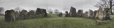
~ 6.3 km W by N, in a field behind a farm, and just visible from the Antrim-Templepatrick road through gaps in the hedge is Kilmakee "Stone Circle" (J 209 851), which is almost certainly the kerb of a now-depleted cairn which may have contained a tomb. The ring of some 45 basalt boulders (some smoothed by water-rolling) has been planted with trees, so that gnarled roots and trunks are growing around the stones and occupying the spaces between, except on the N side where the kerb and cairn have been removed.
~ Just over 7 km NNW is the Holed Stone at Doagh. ~
12 km NE is "Buchanan's Stone" at Castletown
(see under Ballylumford ). Craigs:
Court-tomb and Passage-tomb At a height of 200 metres on Long Mountain, this reconstructed tomb has a large capstone over the entrance and first chamber of the gallery - probably not the original. The almost semicircular forecourt faces SE. Known as The Broad Stone, it was once a popular place of assembly. It is the subject of a poem by the Californian poet Robinson Jeffers.
~ 4.4
km ENE is the fine court-tomb at Ballymacaldrack. Curramoney:
Wedge-tomb About 50 metres W of the road, the small but surprisingly intact Druid's Altar is stoutly fenced - and treated with potent weedkiller when visited in Spring 2002. One of the 4 well-chosen façade-stones is heavily (naturally ?) pocked, and there is a natural cupmark on a Northern kerbstone. At least two chamber-stones project above the cairn, some 12 metres long and largely intact. From this tomb there is a good view of cairn-topped Knocklayd to the E.
~ 5.8 km N by W in Clegnagh (D 025 436) is a passageless passage-tomb with a single capstone. Half of its kerb has fallen into a quarry. ~ 5.3
km NNW in Lemnagh Beg (D 023 433) is another similar
passage-tomb.
Whitepark
Bay was one of the places that the roughed-out obsidian axes
from Tievebulliagh were brought to be finished. ~ 5.8 km N by E of Curraghmoney, in Magheraboy (D 037 437) is 'The Druid Stone', a simple polygonal passage-tomb in a round cairn, supporting a single, massive split-boulder capstone, with traces of a short passage on the NE side. Some 14 kerbstones remain. Doagh:
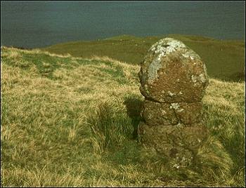
Holed Stone This fine slab, situated
on a rocky outcrop to the SE of Holestone Road, 2 km WNW of
Doagh village, commands wide views. A circular, chamfered hole
some 10 cms in diameter at groin height was made by boring from
both sides of the slab, as is usual in such monuments. In a
significant degeneration of early progenerative practices lovers
plighted their troth by passing a white handkerchief through
the hole. This stone is echoed by another, larger slab with
a similar groin-height hole, straight across the North Channel
at Crows in Galloway.
~ 12 km ENE in Ballynarry (J 367 938), 50 metres from a track, is an irregularly-shaped standing-stone just over 2 metres tall. ~ 2.4 km SE and visible SE of the road from Parkgate to Doagh is the impressive Moyadam Standing-stone, almost 2 metres high with a curious "feminising" groove at the top. ~ 7.2 km SE (on sheet 15) is 'Carn Greine', Craigarogan. ~ 2.4 km W (on sheet 14) in Ballywee (J 218 899) is what the N.I. Sites and Monuments Record describes as "a well-preserved Early Christian settlement site enclosed by 2 arcs of low banks. Gullies running along the outer base of these banks were not defensive, but diverted surface water away from the living area. The entrance to the site was through a gap at SE. In the living area were the remains of 5 Early Christian structures, with 2 further possible structures, and 3 souterrains, the entrances to 2 of which were within buildings. Areas of cobble paving and stone kerbs were also uncovered during excavations, along with 3 hearths." The site was apparently in use as late as 1000 AD. It is listed here because the souterrains are accessible.
~ Closer to The Holestone, at J 228 893 in the same townland of Ballywee, on the N edge of a mound, is a three-chambered souterrain with 'creeps'. ~ 3.4 km W (on sheet 14) in the townland of Tobergill is "The Crags", marked as a stone circle at J 208 905. All but one of the stones have been tumbled. It is probably not a circle, however, but the sad remains of a court-tomb. Between the monument and the by-road to the S is what seems to be a rare example of a surviving quarry from which the stones were hewn.
~ About
5 km WNW (also on sheet 14) in Browndod, up a narrow
lane to the W of the Browndod Road is a court-tomb (J 206 924)
which offers fine views and consists of a clearly-defined forecourt
leading to a gallery 14 metres long, segmented into 4 chambers
by 3 pairs of jambs, two of
The tomb
is set within a long trapezoidal cairn of about 30 x 15 metres,
which was originally covered with earth. Before the stones were
laid the builders made a foundation of red clay carried from
an area a few hundred yards further downhill. During excavation
pottery was found and three ritual pits which were dug very
deeply, reaching below the red clay layer. Unfortunately, a
rather rusty pylon now stands very close to the tomb, somewhat
reducing the otherwise fine setting. ~ Also in the same townland, at J 196 930 is the Tardree Stone, a menhir just over 2 metres high. ~ 9 km WSW (and 6.1 km WSW of Tobergill in the townland of Steeple in the park which houses the Antrim borough council offices (J 155 877), and beside a very fine example of an 11th century Round Tower (outside the scope of this gazetteer), is a large boulder with a double bullaun, probably dating from megalithic times. This makes an excellent picnic place. ~ Just under 9 km NW is the roadside standing-stone at Carncome (see under Ticloy). Galboly
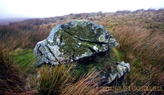
Lower: ?Passage-tombs 500 metres S of the deserted clachan (tiny hamlet) of Galboly is a small tomb comprising a chamber formed by large basalt boulders. It is covered by a large capstone supported on E side by three large boulders and two smaller stones, and on the W side by two boulders. Traces of a roughly oval cairn lie to the N. Another small megalithic tomb lies 25 metres NE, and a possible third just below the plateau. These may all belong to the type of derivative passage-tomb typical of the Antrim coast.
~
6.5 km WNW (on sheet 5) is Lurigethan promontory-fort
(see under Altagore, above). Goakstown
or Gowkstown: Wedge-tomb Half-way up and to the left of a farm-lane running E of the Carncastle-Glenarm road, this fairly well-preserved wedge-tomb still has over 25 stones of its kerb, some of its cairn, sill-stones, and one large roofstone in place, with others displaced. A large façade-stone stands near the entrance. A slab about 120 cms high broken - probably intentionally, to form a 'soul-hole' - at one corner, divides the rectangular portico from the main chamber.
About 150 metres SW, on the other side of the road, is a low standing-stone, but its significance seems paltry compared with the remarkable volcanic plug of Slemish which dominates a great deal of the landscape of SE Antrim. ~ 1.8 km ESE is the phallic standing-stone at Ballygilbert. Lough-na-Cranagh:
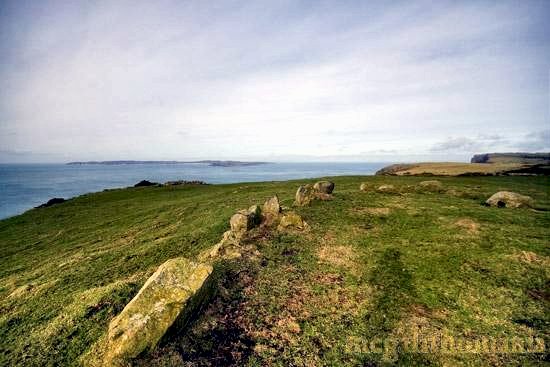
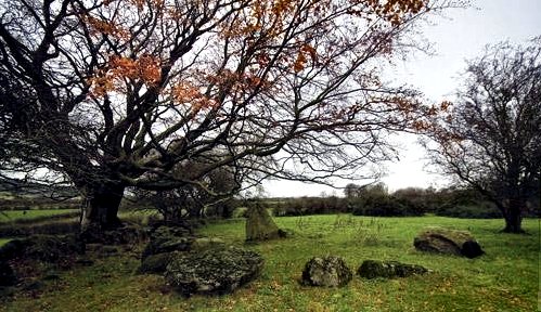
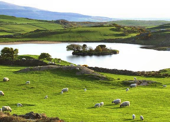
Crannóg Near the summit of Fair Head, this picturesque crannóg or artificial lake-refuge is oval in shape and, unusually, contained by a dry-stone wall. Fair Head is accessible by car as far as the clachan or house-cluster to the S of the Lough where a car park is provided by the National Trust. There is a spectacular view from the top of the sheer, fissured cliffs beyond the Lough, to Rathlin Island and, visibility permitting, the Mull of Kintyre.
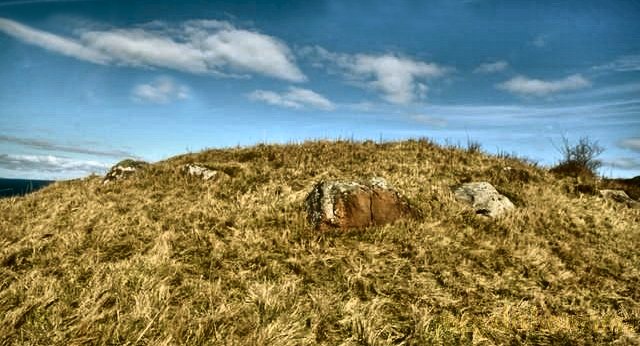
~ About 200 metres SSW in Coolanlough (D 180 422) are the ruins of a possible wedge-tomb, of which just one original stone still stands in the trapezoidal cairn, which has been augmented by field-clearance. The site is listed here because of its situation, and is indicated in the photo below by the arrowhead.
~ 3.7
km SW is the stone pair at Ballynaglogh (see under Ballyvoy). Ticloy:
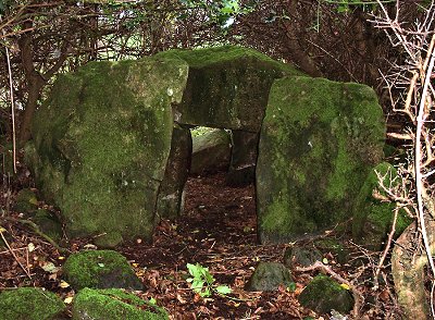
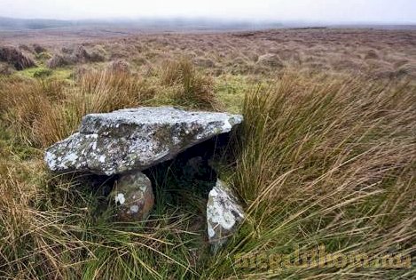
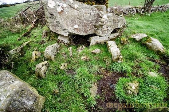
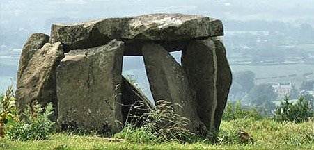
Portal-tomb In
a field 8 km SW of Carnlough, "The Stone House"
has been thought to be a hybrid between a court-tomb and a
portal-tomb. At the E end of what was once a long cairn is
a small chamber up to 1.8 metres high, roofed with 2 capstones
and flanked by 5 orthostats forming a forecourt. A large slab
from the tomb, now incorporated (beside a gate) in a field-wall
to the SW, seems to be all that remains of a second tomb at
the other end of the long cairn which also disappeared in
the 19th century.
~
2.5 km ESE is the huge court-tomb at Antynanum.
~ 12.7 km WNW in Skerry West (D 138 164), easily visible from a road-junction, is a fine standing-stone some 1.8 metres high - one of several still surviving (and marked on the map) in an area previously littered with standing-stones. 1.6 km NW of it (in Scotchomerbane at D 116 175) is another - incorporated in a roadside stone wall.
600 metres SSE of the Skerry West stone, adjoining a field-fence and obscured by a thorn-bush in Lisnamanny (D 131 159) is a taller stone, of basalt, with a pointed top and a deep fissure running down it. At D 134 155 in the same townland is a pair of irregular basalt standing-stones on either side of a farm-track. ~ 11.5 km WSW in Craigywarren (D 125 030) is another standing-stone (low but massive) not marked on the map.
~ 17 km SSW in a bungalow wall in Carncome (J 168 962 on the same map) is a conglomerate stone 2.1 metres high whose surface has many natural pits and hollows.
Tully
North, Loughguile: Standing-stones A large, pointed slab of basalt, some 2 metres high, which according to local information, was moved a short distance to the W when the road was widened, is now at the top of a hill on the W side of the Coolkeeran Road. 400 metres ENE (D 086 253) is another stone, 1.4 metres high. ~ At Corkey North (D 081 235 and D 082 235) are another two stones, 100 metres apart, 2.7 and 2.1 metres high. ~ At Ballyveely Upper (D 076 254) to the NW, is another stone set on top of Cannon Hill. It is a tall, thin slab now incorporated into a field-wall, standing at an angle of 60 degrees. When upright and unencumbered by a wall, this would have been an impressive stone. ~ 4 km N of the Tully North stones, in an uncultivated garden attached to the site of an old corn-mill at Magherahoney, a standing-stone, 3.4 metres long, lies fallen. It is locally known as Saint Patrick ! |
