county list
|
Turn smartphone to horizontal
view.
Place-names in italics refer to listed entries. Convert Irish Grid references to Latitude/Longitude |
|
Clonfertmulloe:
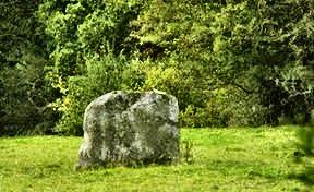
Multiple bullaun 3.2 km NNW of Borris-in-Ossory, 6.4 km ENE of the beautiful early monastic site of Mona Incha, 50 metres from a by-road in a field on the opposite side of the road from a ruined church and 200 metres W of it, is a quartzite boulder measuring 1.5 by 1.6 metres by 60 cms high, with 4 bullauns from 20 to 28 cms deep and 25 to 45 cms wide, and another small half-bullaun. Known as "St Molua's Stone" it is associated with (but probably pre-dates) the nearby monastic site.
~ 6.5 km SSW (4 km SW of Borris-in-Ossory on sheet 60) is Skirk Castle (S 219 840), an Anglo-Norman motte-and-bailey whose bailey (yard) is a circular henge, adapted for mediæval military use. In the centre is a large conglomerate standing-stone, some 2.2 metres high and very phallic from one angle.
Clonfinlough:
Petroglyphic boulder In the middle of a field about 4 km E of the celebrated monastic site of Clonmacnois, near Clonfinlough Catholic church, stands a large, flattish boulder of Carboniferous sandstone over 3 metres long by 2.5 wide, embedded in the side of an esker. It is thickly covered with deeply-incised designs, mostly in the form of cup-marks and elongated crosses, and a design dubbed "The Split Year" (by H. Wirth, 1936): a circle divided in two halves by a vertical line. These occur among solution-pits, some of them foot-shaped. Whether in fact it is prehistoric has been debated. It is certainly not beautiful - unlike the nearest comparison, at Carrowreagh in county Donegal (see under Magheranaul ). But when photographed by Ken Williams it is magically transformed, and can be declared a genuine prehistoric artefact. Clonkeen:
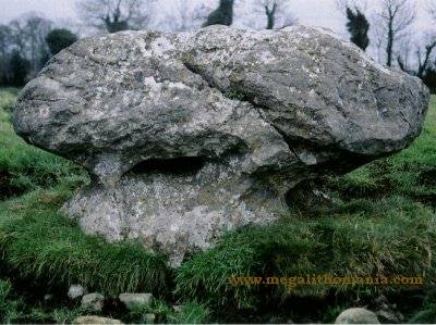
Standing-stone South of the road between the R.442 and the R.400, just south of Clonbulloge (Laois), a remarkable hammer-headed or mushroom-shaped erratic stands in the middle of a field. A 30 cm deep oval depression in the W side is reminiscent of similar depressions in stones at Ballynoe in Down and at the Wicklow stone circles.
Glenafelly:
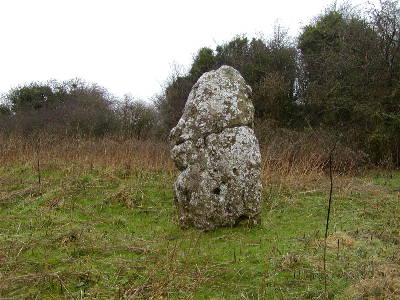
Standing-stone In the heart of the Slieve Bloom 'mountains', this massive Fiddler's Stone is not marked on the OS map but is easy to spot, close to the road opposite a parking area for the Slieve Bloom trail. It is 1.3 metres high and 1.7 metres wide. Lemanaghan:
Bullaun-stones An ancient trackway,
paved with huge blocks of stone, leads around the south of the
ruined twelfth-century St. Manchán's church which incorporates
some Romanesque fragments in the S window, and a fragment of
an ogam inscription in the N wall. Following this takes you
to some other monuments associated with the 7th century monastery.
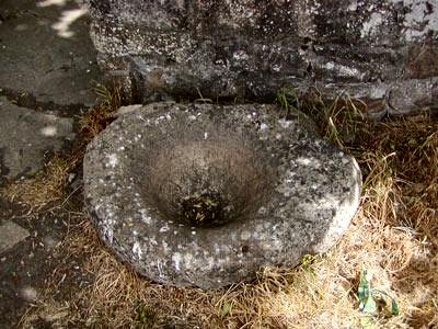
Opposite the National School building and outside the graveyard, built into the wall surrounding the tree in the centre of the road is another bullaun stone: a flat slab measuring 100 by 50 cm with the bullaun (20 cm in diameter and hemispherical) carved in its centre.There is a crack running across the entire width of the stone, through which bindweed grows. ~ At Boher Church, to the E is St. Manchán's Shrine. Manger:
Megalithic kist Hidden beneath a bramble-thicket by the roadside, some 7 km SE of Timahoe (Laois), is a fine example of a megalithic kist, with a slipped roofstone measuring 2.5 x 2.2 metres, and a chamber about 1.4 metres deep. Behind the backstone some dry-stone walling is visible. To the E are the tops of some stones which may be remnants of a surrounding stone circle. Meelaghans:
Multiple bullaun 4.8 km SE of Tullamore
(Offaly) and 800 metres W of Meelaghans crossroads, 400 metres
S of a level crossing in a circular copse of thorn trees, approachable
by a muddy lane and across two fields, "The Nine-Hole Stone"
is a large sunken boulder now surrounded by a little wall. Its
exposed surface (1.8 metres in diameter) displays 6 perfectly-formed
bullauns
up to 30 cms in diameter and half as deep. A seventh is unfinished,
and two further natural depressions make up the nine holes.
~ In another little copse just beyond is another larger and higher boulder containing a single bullaun 35 cms in diameter. Unlike the others it does not hold water, due to a fracture in the limestone. Moyne:
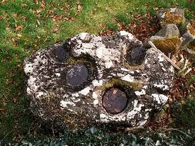
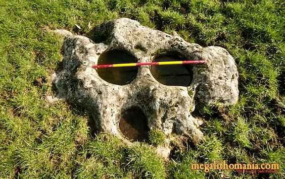
Bullaun 2.5 km NNW of Durrow in Moyne Estate, is a large block of limestone with two very large bullauns.and a third smaller one. The two larger ones are 40 cms in diameter and the smaller one 30 cms. The stick in the photo below is a metre long.
|

